53 search results - page 3 / 11 » A Marked Point Process for Modeling Lidar Waveforms |
GEOINFORMATICA
2007
13 years 5 months ago
2007
Orthophotos (or orthoimages if in digital form) have long been recognised as a supplement or alternative to standard maps. The increasing applications of orthoimages require effor...
ICASSP
2011
IEEE
12 years 9 months ago
2011
IEEE
We present a novel, maximum likelihood framework for automatic spike-sorting based on a joint statistical model of action potential waveform shape and inter-spike interval duratio...
CVPR
2008
IEEE
14 years 7 months ago
2008
IEEE
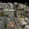
A fast 3D model reconstruction methodology is desirable in many applications such as urban planning, training, and simulations. In this paper, we develop an automated algorithm fo...
JFR
2006
13 years 5 months ago
2006
This paper describes a patent awarded system for automatically marking the positions of stands for a trade fair or exhibition. The system has been in operation since August 2003 a...
ICPR
2010
IEEE
13 years 3 months ago
2010
IEEE
Abstract--In this paper we introduce a probabilistic approach of building extraction in remotely sensed images. To cope with data heterogeneity we construct a flexible hierarchical...


