376 search results - page 75 / 76 » A virtual reality simulator of the ENIAC |
VISUALIZATION
1997
IEEE
13 years 9 months ago
1997
IEEE
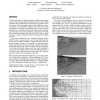
Terrain visualization is a difficult problem for applications requiring accurate images of large datasets at high frame rates, such as flight simulation and ground-based aircraf...
HRI
2007
ACM
13 years 9 months ago
2007
ACM
Operator performance during Space Shuttle and International Space Station robotic arm training can differ dramatically among astronauts. The difficulty making appropriate camera s...
MM
2010
ACM
13 years 5 months ago
2010
ACM
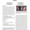
This paper presents some interactive features we have added on our street-view web navigation application. Our system allows to navigate through a huge amount of data (panoramas a...
CGF
2006
13 years 5 months ago
2006
Based on the potential of current programmable GPUs, recently several approaches were developed that use the GPU to calculate deformations of surfaces like the folding of cloth or...
COMCOM
2007
13 years 5 months ago
2007
In this paper, we focus on the challenge of demand-scalable multicast routing in wireless sensor networks. Due to the ad-hoc nature of the placement of the sensor nodes as well as...


