5 search results - page 1 / 1 » Detail-In-Context Visualization for Satellite Imagery |
CGF
2008
13 years 5 months ago
2008
We use the complex logarithm as a transformation for the visualization and navigation of highly complex satellite and aerial imagery. The resulting depictions show details and con...
CORR
2011
Springer
12 years 12 months ago
2011
Springer
This study presents a new visualization tool for classification of satellite imagery. Visualization of feature space allows exploration of patterns in the image data and insight in...
TOG
2010
12 years 11 months ago
2010
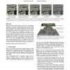
Multiscale imagery often combines several sources with differing appearance. For instance, Internet-based maps contain satellite and aerial photography. Zooming within these maps ...
CLUSTER
2004
IEEE
13 years 8 months ago
2004
IEEE
JuxtaView is a cluster-based application for viewing ultra-high-resolution images on scalable tiled displays. We present in JuxtaView, a new parallel computing and distributed mem...
SIMVIS
2007
13 years 6 months ago
2007
Satellite images of the earth are currently commercially available in resolutions from 14.25m (Landsat 7) up to 0.61m (QuickBird). Visualizing large terrains or whole planets at t...


