14 search results - page 1 / 3 » Optimizing continuity in multiscale imagery |
TOG
2010
13 years 4 months ago
2010
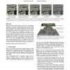
Multiscale imagery often combines several sources with differing appearance. For instance, Internet-based maps contain satellite and aerial photography. Zooming within these maps ...
GD
2000
Springer
14 years 1 months ago
2000
Springer
We present a multi-scale layout algorithm for the aesthetic drawing of undirected graphs with straight-line edges. The algorithm is extremely fast, and is capable of drawing graph...
CIKM
2009
Springer
14 years 4 months ago
2009
Springer
This paper addresses the issue of social recommendation based on collaborative filtering (CF) algorithms. Social recommendation emphasizes utilizing various attributes informatio...
100
click to vote
GIS
2006
ACM
14 years 10 months ago
2006
ACM
Remotely sensed data, in particular satellite imagery, play many important roles in environmental applications and models. In particular applications that study (rapid) changes in...
IPAS
2008
13 years 11 months ago
2008
The automatic detection of runway hazards from a moving platform under poor visibility conditions is a multifaceted problem. The general approach that we use relies on looking at ...


