420 search results - page 1 / 84 » Real-time Terrain Mapping |
DEM
2001
Springer
13 years 9 months ago
2001
Springer
A common concern of the real−time terrain visualisation of today is the lack of geometric detail, when the terrain model is studied close enough. This is primary not a problem of...
ICVS
2009
Springer
13 years 11 months ago
2009
Springer
Abstract. We present a real-time approach for traversable surface detection using a low-cost monocular camera mounted on an autonomous vehicle. The proposed methodology extracts co...
RT
2004
Springer
13 years 10 months ago
2004
Springer
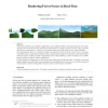
Forests are crucial for scene realism in applications such as flight simulators. This paper proposes a new representation allowing for the real-time rendering of realistic forest...
DAGSTUHL
2010
13 years 6 months ago
2010
Abstract. We present an interactive, real-time mapping system for digital elevation maps (DEMs), which allows Earth scientists to map and therefore understand the deformation of th...
ICVGIP
2008
13 years 6 months ago
2008
We present a non-photo realistic, real-time painterly rendering technique for terrains. The painterly appearance and the impression of terrains is created by effectively rendering...


