362 search results - page 1 / 73 » Topographic Maps of Color Images |
ICPR
2000
IEEE
14 years 5 months ago
2000
IEEE
We address the problem of extending topographic maps to color images. A topographic map gives a morphological and a geometrical representation of the information contained in natu...
ICDAR
2007
IEEE
13 years 10 months ago
2007
IEEE
Topographic paper maps are a common support for geographical information. In the field of document analysis of this kind of support, this paper proposes an automatic approach to ...
ICPR
2008
IEEE
14 years 5 months ago
2008
IEEE
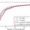
In this paper, we present a set of texture features that are locally invariant to similarity or affinity. The proposed indexing scheme relies on the topographic map, a shape-based...
NGC
2006
Springer
13 years 4 months ago
2006
Springer
This paper examines two seemingly unrelated qualitative spatial reasoning domains; geometric proportional analogies and topographic (landcover) maps. We present a Structure Matchin...
ICANN
2010
Springer
13 years 5 months ago
2010
Springer
One way to handle the perception of images that change in position (or size, orientation or deformation) is to invoke rapidly changing fiber projections to project images into a fi...


