10 search results - page 1 / 2 » apvis 2011 |
APVIS
2011
12 years 4 months ago
2011
APVIS
2011
12 years 4 months ago
2011
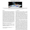
Maps offer a familiar way to present geographic data (continents, countries), and additional information (topography, geology), can be displayed with the help of contours and heat...
APVIS
2011
12 years 4 months ago
2011
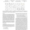
We present the results of a study comparing five directed-edge representations for use in 2D, screen-based node-link diagrams. The goal of this work is to extend the understandin...
APVIS
2011
12 years 4 months ago
2011
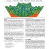
We present an efficient method for volume rendering by raycasting on the CPU. We employ coherent packet traversal of an implicit bounding volume hierarchy, heuristically pruned u...
APVIS
2011
12 years 4 months ago
2011
Many data sets exist that contain both geospatial and temporal elements. Within such data sets, it can be difficult to determine how the data have changed over spatial and tempor...


