GIS
2007
ACM
13 years 8 months ago
2007
ACM
A frequent query in geospatial planning and decision making domains (e.g., emergency response, data acquisition, street cleaning), is to find an optimal traversal plan (OTP) that ...
GIS
2007
ACM
13 years 8 months ago
2007
ACM
Spatial join is an important yet costly operation in spatial databases. In order to speed up the execution of a spatial join, the input tables are often indexed based on their spa...
GIS
2007
ACM
13 years 8 months ago
2007
ACM
In this paper, we consider a traffic information sharing system based on Floating Car Data (FCD). FCD is one of the methods used to gather traffic information; it uses vehicles as...
GIS
2007
ACM
13 years 10 months ago
2007
ACM
As technology advances we encounter more available data on moving objects, thus increasing our ability to mine spatiotemporal data. We can use this data for learning moving object...
GIS
2007
ACM
13 years 10 months ago
2007
ACM
In this paper, we present a technique that generalizes 3D building groups of virtual 3D city models according to a cell structure that is derived from infrastructure networks. In ...
GIS
2007
ACM
14 years 5 months ago
2007
ACM
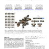
We present a novel framework for organizing large collections of images in a hierarchical way, based on scene semantics. Rather than score images directly, we use them to score th...
GIS
2007
ACM
14 years 5 months ago
2007
ACM
We consider trails to be a document type of growing importance, authored in abundance as locative technologies become embedded in mobile devices carried by billions of humans. As ...
GIS
2007
ACM
14 years 5 months ago
2007
ACM
Many Geographic Information System (GIS) applications must handle large geospatial datasets stored in raster representation. Spatial joins over raster data are important queries i...
GIS
2007
ACM
14 years 5 months ago
2007
ACM
This paper is committed to explore object-oriented methods for the classification of Quickbird images, aiming to support future urban population estimates. The study area concerns...
GIS
2007
ACM
14 years 5 months ago
2007
ACM


