GIS
2009
ACM
14 years 5 months ago
2009
ACM
Map-matching is the process of aligning a sequence of observed user positions with the road network on a digital map. It is a fundamental pre-processing step for many applications...
GIS
2009
ACM
14 years 5 months ago
2009
ACM
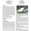
This paper presents a method for automatically converting raw GPS traces from everyday vehicles into a routable road network. The method begins by smoothing raw GPS traces using a...
GIS
2009
ACM
14 years 5 months ago
2009
ACM
We envision participatory texture documentation (PTD) as a process in which a group of users (dedicated individuals and/or general public) with camera-equipped mobile phones parti...
GIS
2009
ACM
14 years 5 months ago
2009
ACM
In this paper we present algorithms for automatically generating a road network description from aerial imagery. The road network inforamtion (RNI) produced by our algorithm inclu...
GIS
2009
ACM
14 years 5 months ago
2009
ACM


