23 search results - page 3 / 5 » 3D City Modeling with Laser Range Data and 2D Maps |
IROS
2009
IEEE
13 years 12 months ago
2009
IEEE
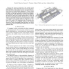
— We present an approach to the problem of 3D map building in urban settings for service robots, using threedimensional laser range scans as the main data input. Our system is ba...
SIGGRAPH
2000
ACM
13 years 9 months ago
2000
ACM
We describe a hardware and software system for digitizing the shape and color of large fragile objects under non-laboratory conditions. Our system employs laser triangulation rang...
IV
2000
IEEE
13 years 9 months ago
2000
IEEE
A system is presented to visualize information about city with a three-dimensional web user interface. We present a novel way to connect a VRML world to an information database. A...
ICRA
2002
IEEE
13 years 10 months ago
2002
IEEE
We describe results on combining depth information from a laser range-finder and color and texture image cues to segment ill-structured dirt, gravel, and asphalt roads as input t...
ICRA
2003
IEEE
13 years 10 months ago
2003
IEEE
— In this paper, we present an image-based robot incremental localization algorithm which uses a panoramic image-based map enhanced with depth from a laser range finder. The ima...


