23 search results - page 1 / 5 » A Bayesian Approach to Building Footprint Extraction from Ae... |
3DPVT
2006
IEEE
13 years 10 months ago
2006
IEEE
Building footprints have been shown to be extremely useful in urban planning, infrastructure development, and roof modeling. Current methods for creating these footprints are ofte...
URBAN
2010
12 years 11 months ago
2010
3DPVT
2006
IEEE
13 years 10 months ago
2006
IEEE
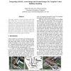
This paper presents a hybrid modeling system that fuses LiDAR data, an aerial image and ground view images for rapid creation of accurate building models. Outlines for complex bui...
GIS
2008
ACM
14 years 5 months ago
2008
ACM
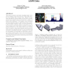
This paper presents an automatic algorithm which reconstructs building models from airborne LiDAR (light detection and ranging) data of urban areas. While our algorithm inherits t...
AIPR
2007
IEEE
13 years 11 months ago
2007
IEEE
Geometric structure of a scene can be reconstructed using many methods. In recent years, two prominent approaches have been digital photogrammetric analysis using passive stereo i...


