Free Online Productivity Tools
i2Speak
i2Symbol
i2OCR
iTex2Img
iWeb2Print
iWeb2Shot
i2Type
iPdf2Split
iPdf2Merge
i2Bopomofo
i2Arabic
i2Style
i2Image
i2PDF
iLatex2Rtf
Sci2ools
ISMAR
2005
IEEE
2005
IEEE
Localisation and Interaction for Augmented Maps
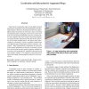
Paper-based cartographic maps provide highly detailed information visualisation with unrivalled fidelity and information density. Moreover, the physical properties of paper afford simple interactions for browsing a map or focusing on individual details, managing concurrent access for multiple users and general malleability. However, printed maps are static displays and while computer-based map displays can support dynamic information, they lack the nice properties of real maps identified above. We address these shortcomings by presenting a system to augment printed maps with digital graphical information and user interface components. These augmentations complement the properties of the printed information in that they are dynamic, permit layer selection and provide complex computer mediated interactions with geographically embedded information and user interface controls. Two methods are presented which exploit the benefits of using tangible artifacts for such interactions.
Afford Simple Interactions | Augmented Reality | ISMAR 2005 | Paper-based Cartographic Maps | User Interface |
Related Content
| Added | 25 Jun 2010 |
| Updated | 25 Jun 2010 |
| Type | Conference |
| Year | 2005 |
| Where | ISMAR |
| Authors | Gerhard Reitmayr, Ethan Eade, Tom Drummond |
Comments (0)

