72 search results - page 1 / 15 » Localisation and Interaction for Augmented Maps |
ISMAR
2005
IEEE
14 years 3 months ago
2005
IEEE
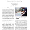
Paper-based cartographic maps provide highly detailed information visualisation with unrivalled fidelity and information density. Moreover, the physical properties of paper affor...
IROS
2006
IEEE
14 years 3 months ago
2006
IEEE
— Service robots designed for domestic settings need to navigate in an environment that they have to share with their users. Thus, they have to be able to report their current st...
ISMAR
2007
IEEE
14 years 3 months ago
2007
IEEE
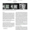
Unknown environments pose a particular challenge for augmented reality applications because the 3D models required for tracking, rendering and interaction are not available ahead ...
CVPR
2010
IEEE
13 years 6 months ago
2010
IEEE
Though modern Visual Simultaneous Localisation and Mapping (vSLAM) systems are capable of localising robustly and efficiently even in the case of a monocular camera, the maps prod...
ISMAR
2003
IEEE
14 years 2 months ago
2003
IEEE
We present a general method for real-time, visiononly single-camera simultaneous localisation and mapping (SLAM) — an algorithm which is applicable to the localisation of any ca...


