27354 search results - page 5302 / 5471 » Distributed And Parallel Computing |
VIS
2005
IEEE
16 years 3 months ago
2005
IEEE
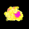
In a visualization of a three-dimensional dataset, the insights gained are dependent on what is occluded and what is not. Suggestion of interesting viewpoints can improve both the...
220
Voted
GIS
2005
ACM
16 years 3 months ago
2005
ACM
Information about dynamic spatial fields, such as temperature, windspeed, or the concentration of gas pollutant in the air, is important for many environmental applications. At th...
265
Voted
GIS
2006
ACM
16 years 3 months ago
2006
ACM
Remotely sensed data, in particular satellite imagery, play many important roles in environmental applications and models. In particular applications that study (rapid) changes in...
200
Voted
GIS
2006
ACM
16 years 3 months ago
2006
ACM
We present a novel method for the automatic generalization of land cover maps. A land cover map is composed of areas that collectively form a tessellation of the plane and each ar...
107
Voted
DAC
2009
ACM
16 years 3 months ago
2009
ACM
In this paper, we propose an effective algorithm flow to handle largescale mixed-size placement. The basic idea is to use floorplanning to guide the placement of objects at the gl...


