72 search results - page 5 / 15 » Localisation and Interaction for Augmented Maps |
139
click to vote
PRESENCE
2002
15 years 1 months ago
2002
In this paper we describe two explorations in the use of hybrid user interfaces for collaborative geographic data visualization. Our first interface combines three technologies; A...
152
click to vote
AINA
2007
IEEE
15 years 3 months ago
2007
IEEE
— We present an augmented map interface called Phygital (physical, digital) Map that enables users to access digital multimedia stored in various off-the-shelf devices from physi...
103
click to vote
BCSHCI
2009
15 years 2 months ago
2009
Augmented tabletops have recently attracted considerable attention in the literature. However, little has been known about the effects that these interfaces have on learning tasks...
UIST
1998
ACM
15 years 6 months ago
1998
ACM
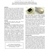
We describe input devices and two-handed interaction techniques to support map navigation tasks. We discuss several design variations and user testing of two-handed navigation tec...
151
click to vote
GRAPHICSINTERFACE
2011
14 years 5 months ago
2011
In traditional graphical user interfaces, the majority of UI elements are hidden to the user in the default view. Application designers and users desire more space for their appli...


