463 search results - page 82 / 93 » Shape and albedo from multiple images using integrability |
168
click to vote
BMCBI
2010
14 years 8 months ago
2010
Background: Digital atlases provide a common semantic and spatial coordinate system that can be leveraged to compare, contrast, and correlate data from disparate sources. As the q...
133
Voted
ROBIO
2006
IEEE
15 years 7 months ago
2006
IEEE
— In this paper we present a multi-sensor fusion system for tracking people with a mobile robot, which integrates the information provided by a laser range sensor and a PTZ camer...
113
Voted
DFMA
2005
IEEE
15 years 7 months ago
2005
IEEE
In this paper, we present an integrated system for real-time dose distribution calculation and treatment planning optimisation for brachytherapy of prostate cancer, with a special...
123
click to vote
TOG
2008
15 years 1 months ago
2008
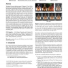
Traditional flat screen displays present 2D images. 3D and 4D displays have been proposed making use of lenslet arrays to shape a fixed outgoing light field for horizontal or bidi...
150
Voted
ICASSP
2011
IEEE
14 years 5 months ago
2011
IEEE
Recognizing the location and orientation of a mobile device from captured images is a promising application of image retrieval algorithms. Matching the query images to an existing...


