307
click to vote
GIS
2009
ACM
16 years 8 months ago
2009
ACM

A common problem in moving object databases (MOD) is the reconstruction of a trajectory from a trajectory sample (i.e., a finite sequence of time-space points). A typical solution...
288
click to vote
GIS
2009
ACM
16 years 8 months ago
2009
ACM

Modern geographic databases can contain a large volume of data that need to be distributed to subscribed customers. The data can be modeled as a cube, where typical dimensions inc...
283
click to vote
GIS
2009
ACM
16 years 8 months ago
2009
ACM
Many popular online services provide "local" or "yellow-pages" search, but none of them allow users to customize the search over user-specified data. Instead, ...
270
click to vote
GIS
2009
ACM
16 years 8 months ago
2009
ACM

A route leads from a start location to a final destination and passes through geospatial entities that are picked according to search terms provided by the user. Each entity is pe...
318
click to vote
GIS
2009
ACM
16 years 8 months ago
2009
ACM
A parallel version of the plane sweep algorithm targeted towards the small number of processing cores available on commonly available multi-core systems is presented. Experimental...
164
click to vote
GIS
2009
ACM
16 years 8 months ago
2009
ACM
Categories and Subject Descriptors General Terms Keywords
329
click to vote
GIS
2009
ACM
16 years 8 months ago
2009
ACM
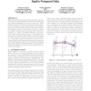
With the recent advancements and wide usage of location detection devices, large quantities of data are collected by GPS and cellular technologies in the form of trajectories. Whi...
308
click to vote
GIS
2009
ACM
16 years 8 months ago
2009
ACM

Map-matching is the process of aligning a sequence of observed user positions with the road network on a digital map. It is a fundamental pre-processing step for many applications...
200
click to vote
GIS
2009
ACM
16 years 8 months ago
2009
ACM
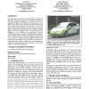
This paper presents a method for automatically converting raw GPS traces from everyday vehicles into a routable road network. The method begins by smoothing raw GPS traces using a...
205
click to vote
GIS
2009
ACM
16 years 8 months ago
2009
ACM
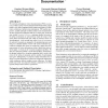
We envision participatory texture documentation (PTD) as a process in which a group of users (dedicated individuals and/or general public) with camera-equipped mobile phones parti...