280
click to vote
GIS
2008
ACM
16 years 8 months ago
2008
ACM
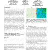
We introduce a parallel approximation of an Over-determined Laplacian Partial Differential Equation solver (ODETLAP) applied to the compression and restoration of terrain data use...
302
click to vote
GIS
2008
ACM
16 years 8 months ago
2008
ACM
We report on our experience from design and implementation of a powerful map application for managing, querying and visualizing evolving locations of moving objects. Instead of bu...
313
click to vote
GIS
2008
ACM
16 years 8 months ago
2008
ACM

This work explores the potential for increased synergy between gazetteers and high-resolution remote sensed imagery. These two data sources are complementary. Gazetteers provide h...
282
Voted
GIS
2008
ACM
16 years 8 months ago
2008
ACM
In this paper we propose to apply hierarchical graphs to indoor navigation. The intended purpose is to guide humans in large public buildings and assist them in wayfinding. We sta...
267
click to vote
GIS
2008
ACM
16 years 8 months ago
2008
ACM
Efficient means of determining factors controlling spatial distribution of an environmental class variable are of significant interest in Earth science. In this paper, we present ...