307
click to vote
GIS
2008
ACM
16 years 8 months ago
2008
ACM

The pervasiveness of location-acquisition technologies (GPS, GSM networks, etc.) enable people to conveniently log the location histories they visited with spatio-temporal data. T...
281
click to vote
GIS
2008
ACM
16 years 8 months ago
2008
ACM
Multi-dimensional spatial data are obtained when a number of data acquisition devices are deployed at different locations to measure a certain set of attributes of the study subje...
278
click to vote
GIS
2007
ACM
16 years 8 months ago
2007
ACM
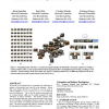
We present a novel framework for organizing large collections of images in a hierarchical way, based on scene semantics. Rather than score images directly, we use them to score th...
305
click to vote
GIS
2007
ACM
16 years 8 months ago
2007
ACM

We consider trails to be a document type of growing importance, authored in abundance as locative technologies become embedded in mobile devices carried by billions of humans. As ...
283
click to vote
GIS
2007
ACM
16 years 8 months ago
2007
ACM
Many Geographic Information System (GIS) applications must handle large geospatial datasets stored in raster representation. Spatial joins over raster data are important queries i...