127 search results - page 13 / 26 » Path selection: a novel interaction technique for mapping ap... |
ACMACE
2006
ACM
15 years 5 months ago
2006
ACM
Recent advances in three-dimensional (3D) data acquisition techniques have offered an alternative to the traditional 2D metamorphosis (or morphing) approaches, which gradually cha...
CGF
2002
14 years 11 months ago
2002
This paper presents an interactive global visualization technique for dense vector fields using levels of detail. We introduce a novel scheme which combines an error-controlled hi...
VIS
2004
IEEE
16 years 1 months ago
2004
IEEE
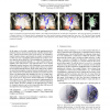
Multi-perspective images are a useful way to visualize extended, roughly planar scenes such as landscapes or city blocks. However, constructing effective multi-perspective images ...
105
click to vote
VISUALIZATION
2005
IEEE
15 years 5 months ago
2005
IEEE
In this paper, we describe a methodology and implementation for interactive dataset traversal using motion-controlled transfer functions. Dataset traversal here refers to the proc...
109
click to vote
GIS
2009
ACM
15 years 3 months ago
2009
ACM
Raster maps are widely available and contain useful geographic features such as labels and road lines. To extract the geographic features, most research work relies on a manual st...


